| Collector | Kvist, L.P. |
| Number | 1145 |
| Collected with | |
| Country | Peru |
| Subpart | Loreto |
| County | |
| Locality | Along the lower Ucayali river, approx. 7 km west of the Jenaro Herrera, "Zona de Braga". |
| Coordinates | 4° 55' S 73° 45' W |
| Minimum elevation (m) | 120 |
| Maximum elevation (m) | 120 |
| Start date | 1994/08/24 |
| End date | 1994/08/27 |
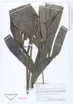
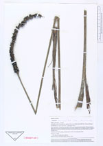
| Family | Arecaceae |
| Identification | Geonoma macrostachys var. macrostachys Mart. |
| Determined by | F. Borchsenius |
| Identification qualifier | |
| Field notes | In or near plot 2, 3 and 4 (of nine 100 x 100 metres large permanent plots). Plots located at large and fairly plain old natural levee maximally flooded a few months annually (restinga). Flooded by a mixture of black water from local upland streams and white water from the Ucayali river.�Common understory palm, inflorescences violet with dull green fruits. 5� |
|