AAU Herbarium Database |
| New Search Modify Search |
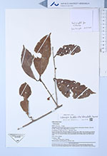
| Collector | Kvist, L. P. |
| Number | 1095 |
| Collected with | J. Ruiz M. |
| Country | Peru |
| Subpart | Loreto |
| County | |
| Locality | Along the lower Ucayali river, approx 7 km southwest of the Jenaro Herrera "Zona de Lobillo" near the small village Nuevo Aucayacu. |
| Coordinates | 4° 59' S 73° 44' W |
| Minimum elevation (m) | 120 |
| Maximum elevation (m) | 120 |
| Start date | 1994/08/15 |
| End date | 1994/08/15 |
| Family | Dilleniaceae |
| Identification | Doliocarpus dentatus subsp. tuberculatus Aymard |
| Determined by | Monzoli, J.V.L. |
| Identification qualifier | |
| Field notes | In plot 6 (of nine 100 x 100 metres large permanent plots). Both plots flooded up to several metres and often for more than a half year annual (tahuampa). Mostly flooded by black water from local upland streams, but occasionally also bu white water from the Ucayali River. Liana, fruits reddish. |
| |
 Other records of Doliocarpus dentatus subsp. tuberculatus Other records of Doliocarpus dentatus subsp. tuberculatusThe map displays only records from the Aarhus Herbarium Database. The records may not represent the full distribution of Doliocarpus dentatus subsp. tuberculatus |
| New Search Modify Search |