AAU Herbarium Database |
| New Search Modify Search |
| Collector | Kvist, L.P. |
| Number | 1077 |
| Collected with | |
| Country | Peru |
| Subpart | Loreto |
| County | |
| Locality | In plot 5 and 6 (of nine 100 x 100 metres large permanent plots). Both plots flooded up to several metres and often for more than a half year anually (tahuampa). Mostly flooded by black water from local upland streams, but occasionally also by white water from the Ucayali River. |
| Coordinates | 4° 59' S 73° 44' W |
| Minimum elevation (m) | 120 |
| Maximum elevation (m) | 120 |
| Start date | 1994/08/09 |
| End date | 1994/08/10 |
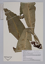
| Family | Aspleniaceae |
| Identification | Asplenium serratum L. |
| Determined by | B.Ollgaard |
| Identification qualifier | |
| Field notes | Epiphytic fern. |
| |
| Display all 84 georeferenced records of Asplenium Asplenium serratum |
| New Search Modify Search |