AAU Herbarium Database |
| New Search Modify Search |
| Collector | Holm-Nielsen, L. B. |
| Number | 28698 |
| Collected with | Jaramillo, J. |
| Country | Ecuador |
| Subpart | TUNGURAHUA |
| County | |
| Locality | Cordillera de los Llanganates. Loma 3 km SW of Cerro Hermoso. Polylepis forest and vertical rocks. |
| Coordinates | 1° 14' S 78° 18' W |
| Minimum elevation (m) | 3700 |
| Maximum elevation (m) | 3700 |
| Start date | 1980/11/12 |
| End date | 1980/11/12 |
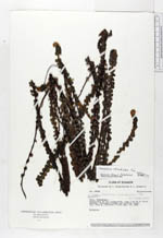
| Family | Pteridaceae |
| Identification | Jamesonia rotundifolia FŽe |
| Determined by | Arbelaez, A. L. (MO), 2000. |
| Identification qualifier | |
| Field notes | Epiphyte. |
| |
 Other records of Jamesonia rotundifolia Other records of Jamesonia rotundifoliaThe map displays only records from the Aarhus Herbarium Database. The records may not represent the full distribution of Jamesonia rotundifolia |
| New Search Modify Search |