| Collector | Holm-Nielsen, L. B. |
| Number | 28557 |
| Collected with | Jaramillo, J. |
| Country | Ecuador |
| Subpart | TUNGURAHUA |
| County | |
| Locality | Cordillera de los Llanganates. At Río Verde Grande at base of Cerro Hermoso, 2.5 km SW of the summit. Polylepis forest. |
| Coordinates | 1° 14' S 78° 18' W |
| Minimum elevation (m) | 3700 |
| Maximum elevation (m) | 3700 |
| Start date | 1980/11/12 |
| End date | 1980/11/12 |
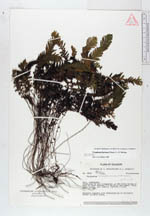
| Family | Grammitidaceae |
| Identification | Ceradenia farinosa (Hook.)L.E. Bishop |
| Determined by | L.E. Bishop (UC), 1988. |
| Identification qualifier | |
| Field notes | Epiphyte together with Hymenophyllum on Polylepis. Leaves silverly white. |
|
 Other records of Ceradenia farinosa