| Collector | Holm-Nielsen, L. B. |
| Number | 28370 |
| Collected with | Jaramillo, J. |
| Country | Ecuador |
| Subpart | TUNGURAHUA |
| County | |
| Locality | Cordillera de los Llanganates. At Río Verde Grande at base of Cerro Hermoso, 2.2 km WSW of the summit. Polylepis forest. |
| Coordinates | 1° 13' S 78° 18' W |
| Minimum elevation (m) | 3750 |
| Maximum elevation (m) | 3750 |
| Start date | 1980/11/11 |
| End date | 1980/11/11 |
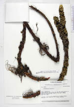
| Family | Lycopodiaceae |
| Identification | Huperzia transilla (Baker)Holub |
| Determined by | Ollgaard, B. (AAU), 1994. |
| Identification qualifier | |
| Field notes | Dominant in Neurolepis-vegetation on steep slopes. Prostate, red, stems to 2 m. Leaves reddish. |
|
 Other records of Huperzia transilla