| Collector | Holm-Nielsen, L. B. |
| Number | 28354 |
| Collected with | Jaramillo, J. |
| Country | Ecuador |
| Subpart | TUNGURAHUA |
| County | |
| Locality | Cordillera de los Llanganates. Saddle between Río Topand Río Verde Grande on W slope of Cerro Hermoso, 2.4 km from the summit. Polylepis scrub. |
| Coordinates | 1° 13' S 78° 18' W |
| Minimum elevation (m) | 3850 |
| Maximum elevation (m) | 3850 |
| Start date | 1980/11/10 |
| End date | 1980/11/10 |
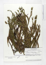
| Family | Lycopodiaceae |
| Identification | Huperzia lindenii (Spring)Trevis. |
| Determined by | Ollgaard, B. (AAU), 1994. |
| Identification qualifier | |
| Field notes | Epiphyte. |
|