AAU Herbarium Database |
| New Search Modify Search |
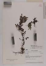
| Collector | Holm-Nielsen, L. B. |
| Number | 28283 |
| Collected with | Jaramillo, J. |
| Country | Ecuador |
| Subpart | NAPO |
| County | |
| Locality | Cordillera de los Llanganates. Loma between Río Topo and Río Verde Grande, 3.5 km NW of Cerro Hermoso. Polylepis scrub. |
| Coordinates | 1° 12' S 78° 18' W |
| Minimum elevation (m) | 4000 |
| Maximum elevation (m) | 4000 |
| Start date | 1980/11/10 |
| End date | 1980/11/10 |
| Family | Lamiaceae |
| Identification | Satureja tenella Epl. |
| Determined by | R. M. Harley, 1990 (K) |
| Identification qualifier | |
| Field notes | Prostrate. Flowers nearly white. |
| |
 Other records of Satureja tenella Other records of Satureja tenellaThe map displays only records from the Aarhus Herbarium Database. The records may not represent the full distribution of Satureja tenella |
| New Search Modify Search |