AAU Herbarium Database |
| New Search Modify Search |
| Collector | Averyanov, L. |
| Number | VH4075 |
| Collected with | N.Q.Binh, P.K.Loc |
| Country | Vietnam |
| Subpart | Lam Dong |
| County | |
| Locality | Municipalite Da Chay, 35 km to NE from Dalat city. Closed primary broadleaved evergreen mt forest with Pinus krempfii on W macroslope of Gia Rinh mt ridge. |
| Coordinates | 12° 9' N 108° 41' E |
| Minimum elevation (m) | 1800 |
| Maximum elevation (m) | 1800 |
| Start date | 1997/04/18 |
| End date | 1997/04/18 |
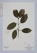
| Family | Rubiaceae |
| Identification | Urophyllum Wall. |
| Determined by | |
| Identification qualifier | |
| Field notes | Shrub 3-4 m hg. Flowers blak. Not rare. |
| |
| Display all 41 georeferenced records of Urophyllum Urophyllum |
| New Search Modify Search |