AAU Herbarium Database |
| New Search Modify Search |
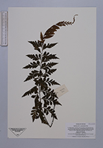
| Collector | Averyanov, L. |
| Number | VH3378 |
| Collected with | N.Q.Bihn, P.K.Loc |
| Country | Vietnam |
| Subpart | Lam Dong |
| County | |
| Locality | Distr. Lac Duong, municipalite Da Chay, 32.5 km to NE from Dalat city. Closed primary broadleaved mt forest along very wet deep stream canyon on NNW macroslope of Bi Dup mt system in 6-7 km to NNW from main peak. |
| Coordinates | 12° 7' N 108° 41' E |
| Minimum elevation (m) | 1600 |
| Maximum elevation (m) | 1800 |
| Start date | 1997/03/30 |
| End date | 1997/03/30 |
| Family | Aspleniaceae |
| Identification | Asplenium praemorsum Sw. |
| Determined by | |
| Identification qualifier | |
| Field notes | Epiphyte. Not common. |
| |
| Display all 26 georeferenced records of Asplenium Asplenium praemorsum |
| New Search Modify Search |