AAU Herbarium Database |
| New Search Modify Search |
| Collector | Averyanov, L. |
| Number | VH1710 |
| Collected with | et.al. |
| Country | Vietnam |
| Subpart | S.Vietnam |
| County | |
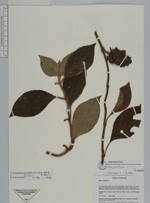
| Locality | Kon Tum, Distr Dak Gley, about 12 km to N of Dak Gley town ( 24 km by road ), near Mang Khen village. Secondary wet mountain evergreen forest rich in primary element |
| Coordinates | |
| Minimum elevation (m) | 1100 |
| Maximum elevation (m) | 1200 |
| Start date | 1995/11/16 |
| End date | 1995/11/16 |
| Family | Lamiaceae |
| Identification | Gomphostemma pedunculatum Benth. ex Hook.f. |
| Determined by | B. Bongcheewin |
| Identification qualifier | |
| Field notes | Prostrate herb rooting at nodes. Not rare. Flower white, sometimes light violet |
| |
| This record has no coordinates. Display map with the 2 georeferenced records of Gomphostemma pedunculatum in the AAU Herbarium Database. |
| New Search Modify Search |