AAU Herbarium Database |
| New Search Modify Search |
| Collector | Averyanov, L. |
| Number | VH1649 |
| Collected with | N.T. Ban, N.Q. Binh, A. Budantzev, L. Budantzev, N.T. Hiep, D.D. Huyen, G. Yakolev |
| Country | Vietnam |
| Subpart | Kontum |
| County | |
| Locality | Distr. Dak Gley, about 12 km to N of Dak Gley town (24 km by road), near Mang Khen village. Primary wet mountain evergreen forest on slope on N exposition. |
| Coordinates | |
| Minimum elevation (m) | 1100 |
| Maximum elevation (m) | 1200 |
| Start date | 1995/11/14 |
| End date | 1995/11/14 |
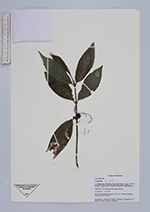
| Family | Rubiaceae |
| Identification | Urophyllum Wall. |
| Determined by | |
| Identification qualifier | |
| Field notes | Shrub about 1.5 m high. Ripe fruits orange. Not rare. |
| |
| This record has no coordinates. Display map with the 41 georeferenced records of Urophyllum in the AAU Herbarium Database. |
| New Search Modify Search |