AAU Herbarium Database |
| New Search Modify Search |
| Collector | Averyanov, L. |
| Number | VH1438 |
| Collected with | N.T.Ban, N.Q.Bihn, A.Budantzev, L.Budantzev, N.T.Hiep, D.D.Huyen, P.K.Loc, N.X. Tam, G.Yakovlev |
| Country | Vietnam |
| Subpart | Khanh Hoa |
| County | |
| Locality | Open dry evergreen forest on cliffs, on NE slope of Bi Dup mountain system, near 5-6 km W of Khanh Le village on Lieng Ly river (near 15 km to W of Cau Ba village). |
| Coordinates | |
| Minimum elevation (m) | 400 |
| Maximum elevation (m) | 600 |
| Start date | 1995/04/23 |
| End date | 1995/04/23 |
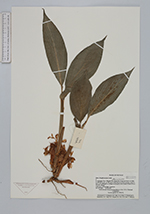
| Family | Zingiberaceae |
| Identification | Amomum |
| Determined by | |
| Identification qualifier | |
| Field notes | Herb up to 0.4 m high. Common. |
| |
| This record has no coordinates. Display map with the 79 georeferenced records of Amomum in the AAU Herbarium Database. |
| New Search Modify Search |