AAU Herbarium Database |
| New Search Modify Search |
| Collector | Averyanov, L. |
| Number | CBL769 |
| Collected with | P.K. Loc |
| Country | Vietnam |
| Subpart | Cao Bang |
| County | |
| Locality | Distr. Ha Lang, municipality An Lac, vicinities of Phia Deng village, about 36 km to E from Cao Bang town. Primary open coniferous forest (with Keteleeria fortunei) along tops of remnant limestone ridge. |
| Coordinates | 22° 43' N 106° 36' E |
| Minimum elevation (m) | 600 |
| Maximum elevation (m) | 600 |
| Start date | 1998/11/29 |
| End date | 1998/11/29 |
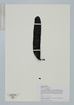
| Family | Fabaceae |
| Identification | Gleditsia |
| Determined by | |
| Identification qualifier | |
| Field notes | Tree up to 20-25 m hg. Codominante of 1 forest stratum on slopes near top of ridge |
| |
| New Search Modify Search |