AAU Herbarium Database |
| New Search Modify Search |
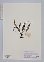
| Collector | Averyanov, L. |
| Number | CBL519 |
| Collected with | P.K.Loc, N.X.Tam |
| Country | Vietnam |
| Subpart | Cao Bang |
| County | |
| Locality | Distr. Nguyen Binh, municipality Ca Thanh, vicinities Ca Lu village, about 7-8 km to SE from Yen Lac village, about 38 km to NWW from Cao Bang town. Secondary forest on alluvial foothills of karst remnant limestone ridge. |
| Coordinates | 22° 44' N 105° 50' E |
| Minimum elevation (m) | 1200 |
| Maximum elevation (m) | 1200 |
| Start date | 1998/11/21 |
| End date | 1998/11/21 |
| Family | Aspleniaceae |
| Identification | Asplenium |
| Determined by | |
| Identification qualifier | |
| Field notes | Epilite forb on open bluffs. Common. |
| |
| Display all 251 georeferenced records of Asplenium Asplenium |
| New Search Modify Search |