AAU Herbarium Database |
| New Search Modify Search |
| Collector | Averyanov, L. |
| Number | CBL1117 |
| Collected with | N.Q.Binh, P.K.Loc, N.X.Tam, N.T. Hiep |
| Country | Vietnam |
| Subpart | Cao Bang |
| County | |
| Locality | Prov. Cao Bang, Distr. Tra Linh, Municipality Co Muoi, vivitnities of Lung Dat village, about 21 km from Cao Bang town to the N. Primary mixed semideciduous forest with Ketelleria fortunei, along tops of limestone ridge. |
| Coordinates | 22° 51' N 106° 14' E |
| Minimum elevation (m) | 900 |
| Maximum elevation (m) | 1000 |
| Start date | 1998/12/12 |
| End date | 1998/12/12 |
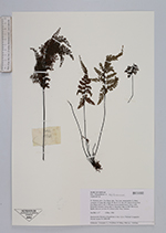
| Family | Aspleniaceae |
| Identification | Asplenium |
| Determined by | |
| Identification qualifier | |
| Field notes | Epilite fern on crevices of vertical cliffs. Very common. |
| |
| Display all 251 georeferenced records of Asplenium Asplenium |
| New Search Modify Search |