AAU Herbarium Database |
| New Search Modify Search |
| Collector | Romoleroux, K. |
| Number | 3069 |
| Collected with | G. Villa & L. Valez |
| Country | Ecuador |
| Subpart | Napo |
| County | |
| Locality | ESTACÍON CIENTÍFICA YASUNÍ. Rio Tiputini, al noroeste de la confluencia con el R. Tivacuno; 6 km este de la carretera Maxus, km 44, deviso hacia el pozo Tivacuno. Arbol con placa # 122935. Terra firme; lomas de 30-50 m, de arcilla rojoza. |
| Coordinates | 0° 59' S 77° 45' W |
| Minimum elevation (m) | 200 |
| Maximum elevation (m) | 300 |
| Start date | 1998/01/22 |
| End date | 1998/01/22 |
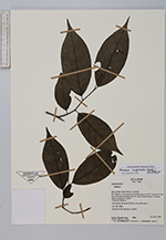
| Family | Annonaceae |
| Identification | Annona cuspidata (Mart.) H.Rainer |
| Determined by | Dr. Paul Maas |
| Identification qualifier | |
| Field notes | Arbol de 10; botones verdes. |
| |
 Other records of Annona cuspidata Other records of Annona cuspidataThe map displays only records from the Aarhus Herbarium Database. The records may not represent the full distribution of Annona cuspidata |
| New Search Modify Search |