AAU Herbarium Database |
| New Search Modify Search |
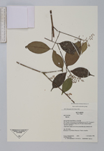
| Collector | Romoleroux, K. |
| Number | 2531 |
| Collected with | M. Bass |
| Country | Ecuador |
| Subpart | Napo |
| County | |
| Locality | Estación Científica Yasuní. Rio Tiputini, al noroeste de la confluencia con el R. Tivacuno; 6 km este de la carretera Maxus, km 44, desvio hacia el pozo. |
| Coordinates | 0° 38' S 76° 30' W |
| Minimum elevation (m) | 200 |
| Maximum elevation (m) | 300 |
| Start date | 1996/11/01 |
| End date | 1996/11/01 |
| Family | Myrtaceae |
| Identification | Myrcia DC. |
| Determined by | M.L. Kawasaki & B. Holst |
| Identification qualifier | |
| Field notes | Arbusto, 4m; flores blancas; frutos rosados. |
| |
 Other records of Myrcia Other records of MyrciaThe map displays only records from the Aarhus Herbarium Database. The records may not represent the full distribution of Myrcia |
| New Search Modify Search |