| Collector | Romoleroux, K. |
| Number | 1891 |
| Collected with | R.Foster |
| Country | Ecuador |
| Subpart | Napo |
| County | |
| Locality | Estación Científica Yasuní, 2 km NW de la Estación, a llanura inundada del río Tiputini. |
| Coordinates | 0° 38' S 76° 30' W |
| Minimum elevation (m) | 200 |
| Maximum elevation (m) | 300 |
| Start date | 1995/10/23 |
| End date | 1995/10/23 |
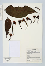
| Family | Lecythidaceae |
| Identification | Gustavia hexapetala (Aubl.)Smith |
| Determined by | |
| Identification qualifier | |
| Field notes | Árbol 30 m, 30 cm diam.; corola cream amarillenta; estambres cream amarillentos; fruto inmaduro verde con amarillo. |
|
 Other records of Gustavia hexapetala