AAU Herbarium Database |
| New Search Modify Search |
| Collector | Wong, K.M. |
| Number | WKM3318 |
| Collected with | A.K. Muhd Ariffin, E. Jangarun |
| Country | Brunei |
| Subpart | Temburong |
| County | |
| Locality | Ulu Temburong National Park, South of Helicopter Landing Point LP 58. Upland mixed dipterocarp forest in transition to lower montane forest, moist hillside. |
| Coordinates | |
| Minimum elevation (m) | 1000 |
| Maximum elevation (m) | 1000 |
| Start date | 2014/08/07 |
| End date | 2014/08/07 |
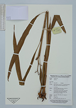
| Family | Zingiberaceae |
| Identification | Alpinia |
| Determined by | |
| Identification qualifier | |
| Field notes | Terrestrial herb, stem 60 cm high. Leaves linear, with steep lateral veins that are raised above., recessed below. Infructescence terminal, fruits globose, pale green, 2 cm diam. |
| |
| This record has no coordinates. Display map with the 35 georeferenced records of Alpinia in the AAU Herbarium Database. |
| New Search Modify Search |