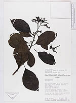
| Collector | Zaruma, J. |
| Number | 161 |
| Collected with | D. Neill, M. Baker, W. Palacios |
| Country | Ecuador |
| Subpart | Napo |
| County | |
| Locality | 15 km al S de Coca, via de los Aucas. Bosque humedo tropical. suelo rojo lateritico |
| Coordinates | 0° 35' S 76° 55' W |
| Minimum elevation (m) | 250 |
| Maximum elevation (m) | 250 |
| Start date | 1985/04/21 |
| End date | 1985/04/21 |
| Family | Boraginaceae |
| Identification | Tournefortia bicolor Sw. |
| Determined by | James S. Miller |
| Identification qualifier | |
| Field notes | Arbusto de 3 m; frutos blancos y verdes; creciendo en bosque primario |
|
 Other records of Tournefortia bicolor