AAU Herbarium Database |
| New Search Modify Search |
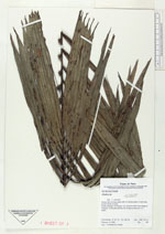
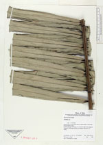
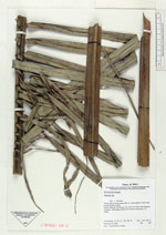
| Collector | Vormisto, J. |
| Number | 99 |
| Collected with | G.Criollo |
| Country | Peru |
| Subpart | Loreto |
| County | |
| Locality | Maynas. Rio Nanay. Ca. 5,5 km to NW of the village of Tarapoto. Unflooded primary rain forest on clay soil, in a valley |
| Coordinates | 3° 47' S 73° 28' W |
| Minimum elevation (m) | 100 |
| Maximum elevation (m) | 150 |
| Start date | 1996/02/19 |
| End date | 1996/02/19 |
| Family | Arecaceae |
| Identification | Attalea |
| Determined by | |
| Identification qualifier | |
| Field notes | Petiole 185 cm long, blade 346 cm, leaves green in both side, pinnae 78-82 cm long |
| |
 Other records of Attalea Other records of AttaleaThe map displays only records from the Aarhus Herbarium Database. The records may not represent the full distribution of Attalea |
| New Search Modify Search |