AAU Herbarium Database |
| New Search Modify Search |
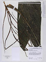
| Collector | Vormisto, J. |
| Number | 768 |
| Collected with | S. Poulsen, H. Balslev |
| Country | Peru |
| Subpart | |
| County | |
| Locality | Loreto, Loreto. Rio Urituyacu. NE from the village of Guineal. Old-growth forest on paleo-riverine terrace, just above the active floodplain in the large alluvial Pastaza fan. Soil dark brown, clayisk, and with a >1cm thick organic layer |
| Coordinates | 4° 21' S 75° 48' W |
| Minimum elevation (m) | 130 |
| Maximum elevation (m) | 130 |
| Start date | 2003/08/12 |
| End date | 2003/08/12 |
| Family | Arecaceae |
| Identification | Chamaedorea pauciflora Mart. |
| Determined by | Vormisto |
| Identification qualifier | |
| Field notes | |
| |
| Display all 97 georeferenced records of Chamaedorea Chamaedorea pauciflora |
| New Search Modify Search |