| Collector | Vormisto, J. |
| Number | 682 |
| Collected with | A. Byg |
| Country | Ecuador |
| Subpart | ZAMORA-CHINCHIPE/NANGARITZA |
| County | |
| Locality | Río Nangaritza. Ca. 0,8 km to S from the village of Miazi. Premontane, unflooded, old-growth rain forest on clay soil. |
| Coordinates | 4° 16' S 78° 38' W |
| Minimum elevation (m) | 880 |
| Maximum elevation (m) | 920 |
| Start date | 2002/12/04 |
| End date | 2002/12/04 |
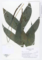
| Family | Arecaceae |
| Identification | Geonoma macrostachys Mart. |
| Determined by | J. Vormisto 2003 |
| Identification qualifier | |
| Field notes | Blade 45 cm, petiole 22 cm. Three inflorescences, peduncles 32-49 cm and spikes 12-14 cm long. macrostachys var. Acaulis |
|