AAU Herbarium Database |
| New Search Modify Search |
| Collector | Vormisto, J. |
| Number | 527 |
| Collected with | S. Wendelboe, H. Balslev |
| Country | Peru |
| Subpart | Lorato |
| County | |
| Locality | Maynas. Close to the village of Cahuide. Old-growth, non-inundated forest on loamy soil. |
| Coordinates | 4° 14' S 73° 28' W |
| Minimum elevation (m) | 100 |
| Maximum elevation (m) | 150 |
| Start date | 2002/06/22 |
| End date | 2002/06/22 |
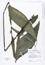
| Family | Arecaceae |
| Identification | Geonoma camana Trail |
| Determined by | J. Vormisto 2003 |
| Identification qualifier | aff. |
| Field notes | Hight 0,5 m. DBH 10 cm. Stem somewhat procumbent. Blade 100 cm and petiole 113 cm long. Leaves green in both sides, brown tomentum along the veins |
| |
| Display all 57 georeferenced records of Geonoma Geonoma camana |
| New Search Modify Search |