AAU Herbarium Database |
| New Search Modify Search |
| Collector | Vormisto, J. |
| Number | 120 |
| Collected with | Criollo, G. |
| Country | Peru |
| Subpart | Loreto |
| County | |
| Locality | Maynas. Río Nanay. Ca. 5,5 km to NW of the village of Tarapoto. Unflooded primary rain forest on clay soil, in a valley. |
| Coordinates | 3° 47' S 73° 28' W |
| Minimum elevation (m) | 100 |
| Maximum elevation (m) | 150 |
| Start date | 1996/02/20 |
| End date | 1996/02/20 |
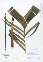
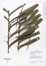
| Family | Arecaceae |
| Identification | Geonoma camana Trail |
| Determined by | Borchsenius, F. |
| Identification qualifier | |
| Field notes | Petiole 71 - 85 cm long, blade 108- 135 cm, leaflets 25 per side. Brown indument on the petiole and the leaf-axis. |
| |
| Display all 57 georeferenced records of Geonoma Geonoma camana |
| New Search Modify Search |