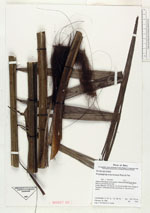
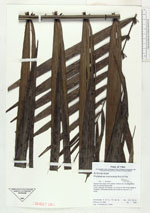
| Collector | Vormisto, J. |
| Number | 101 |
| Collected with | G.Criollo |
| Country | Peru |
| Subpart | Loreto |
| County | |
| Locality | Maynas. Rio Nanay. Ca. 5,5 km to NW of the village of Tarapoto. Unflooded primary rain forest on clay soil, in a valley |
| Coordinates | 3° 47' S 73° 28' W |
| Minimum elevation (m) | 100 |
| Maximum elevation (m) | 150 |
| Start date | 1996/02/19 |
| End date | 1996/02/19 |
| Family | Arecaceae |
| Identification | Phytelephas macrocarpa Ruiz & Pav. |
| Determined by | |
| Identification qualifier | |
| Field notes | Fibres at the base of the petiole. Petiole 210 cm long, blade 300 cm, pinnae 50 per side |
|
 Other records of Phytelephas macrocarpa