AAU Herbarium Database |
| New Search Modify Search |
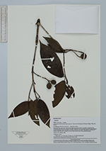
| Collector | Ruiz, J. |
| Number | 9731 |
| Collected with | Lars P. Kvist & Luis Freitas |
| Country | Ecuador |
| Subpart | Loreto |
| County | |
| Locality | Along the lower Ucayali river approx 7 km west of the Jenaro Herrare village, "Zone de Braga. From plot 9 (of nine 100 x 100 metres large permanent plots). Located at natural levee, maximally flooded a few month annually (restinga), but traversed by several metres deeper ravines (bajiales often flooded more than a half year annually. Flooded by a mixture of white water from the Ucayali river and black water from loacal upland streams. |
| Coordinates | 4° 55' S 73° 45' W |
| Minimum elevation (m) | 120 |
| Maximum elevation (m) | 120 |
| Start date | 1993/09/01 |
| End date | 1994/02/12 |
| Family | Rubiaceae |
| Identification | Simira |
| Determined by | |
| Identification qualifier | |
| Field notes | Tree 8 m. 198 mm dbh. |
| |
 Other records of Simira Other records of SimiraThe map displays only records from the Aarhus Herbarium Database. The records may not represent the full distribution of Simira |
| New Search Modify Search |