AAU Herbarium Database |
| New Search Modify Search |
| Collector | Prado, J. |
| Number | 65 |
| Collected with | et al. |
| Country | Brazil |
| Subpart | |
| County | |
| Locality | Estado de Minas Gerais, Municipio de Santana do Riacho, estrada de Lagoa Santa a Conceicão do Mato de Dentro, km. 113, Serra do Cipó, corrego do Vitalino. Hab,:Campo rupestre, a ca. 1150 m alt. Sob rochas, terrestre., 6 sombre, margem do corrego |
| Coordinates | 19° 20' S 43° 40' W |
| Minimum elevation (m) | 1150 |
| Maximum elevation (m) | 1150 |
| Start date | 1987/02/01 |
| End date | 1987/02/01 |
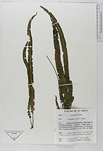
| Family | Dennstaedtiaceae |
| Identification | Lindsaea stricta (Sw.)Dryand. |
| Determined by | Øllgaard, B. & Windisch |
| Identification qualifier | |
| Field notes | |
| |
 Other records of Lindsaea stricta Other records of Lindsaea strictaThe map displays only records from the Aarhus Herbarium Database. The records may not represent the full distribution of Lindsaea stricta |
| New Search Modify Search |