AAU Herbarium Database |
| New Search Modify Search |
| Collector | Mogea, J.P. |
| Number | 6305 |
| Collected with | |
| Country | Indonesia |
| Subpart | Irian Jaya |
| County | |
| Locality | Manokwari. Around a construction main road of Manokwari - Sorong, between Wariari River and Waramoi River. Disturbed lowland primary forest |
| Coordinates | |
| Minimum elevation (m) | 400 |
| Maximum elevation (m) | 600 |
| Start date | 1994/04/26 |
| End date | 1994/04/26 |
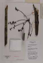
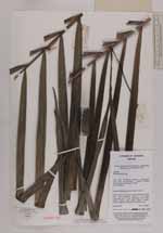
| Family | Arecaceae |
| Identification | Hydriastele |
| Determined by | |
| Identification qualifier | |
| Field notes | treelet, 8 m tall, in clump, stem particulary at the base 3.5 cm diameter. Leaves 7 in crown, crownshaft 65 cm long, leafsheath 45 cm long, petiole 15-20 cm long, blade 120x80 cm. Leaflets regulary arranged, 22 on either side |
| |
| This record has no coordinates. Display map with the 9 georeferenced records of Hydriastele in the AAU Herbarium Database. |
| New Search Modify Search |