AAU Herbarium Database |
| New Search Modify Search |
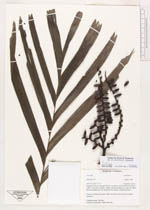
| Collector | Feil, J.P. |
| Number | 2 |
| Collected with | et al. |
| Country | Cambodia |
| Subpart | Kampot |
| County | |
| Locality | Kampot District, southern summit of Phnom Bokor, valley 5 km ESE of Bokor Village. Some km along river into the valley, only accessible this way during the dry season. Evergreen forest. |
| Coordinates | 10° 37' N 104° 3' E |
| Minimum elevation (m) | 720 |
| Maximum elevation (m) | 720 |
| Start date | 1998/04/04 |
| End date | 1998/04/04 |
| Family | Arecaceae |
| Identification | Pinanga Blume |
| Determined by | A.S.Barfod & J.Dransfield |
| Identification qualifier | |
| Field notes | Common understorey palm. Multi-stemmed. Green fruits, perhaps immature. Common name: Sla Prey. Used fro construction. Beds and roofs. |
| |
 Other records of Pinanga Other records of PinangaThe map displays only records from the Aarhus Herbarium Database. The records may not represent the full distribution of Pinanga |
| New Search Modify Search |