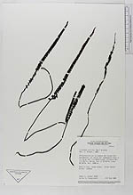
| Collector | Luteyn, J.L. |
| Number | 9426 |
| Collected with | Steyermark,J.A. |
| Country | Venezuela |
| Subpart | Amazonas |
| County | |
| Locality | Altiplanicie en la cumbre del brazo noroccidental, al norte del campamento base a lo largo del rio Mawarinuma, afluente del rio Baria |
| Coordinates | 0° 52' N 66° 5' W |
| Minimum elevation (m) | 1880 |
| Maximum elevation (m) | 1880 |
| Start date | 1984/02/07 |
| End date | 1984/02/08 |
| Family | Dennstaedtiaceae |
| Identification | Lindsaea stricta (Sw.)Dryand. |
| Determined by | Mickel,J. |
| Identification qualifier | |
| Field notes | Fern in dry, rocky areas. Stipe ebonyblack. Common |
|
 Other records of Lindsaea stricta