AAU Herbarium Database |
| New Search Modify Search |
| Collector | Luteyn, J.L. |
| Number | 6386 |
| Collected with | M. Lebrón-Luteyn |
| Country | Peru |
| Subpart | Cuzco |
| County | |
| Locality | Region of Acanacu and the Cordillera of Tres Cruces. |
| Coordinates | |
| Minimum elevation (m) | 3290 |
| Maximum elevation (m) | 3500 |
| Start date | 1978/12/07 |
| End date | 1978/12/07 |
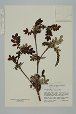
| Family | Rosaceae |
| Identification | Polylepis pauta Hier. |
| Determined by | T.E. Boza E. |
| Identification qualifier | |
| Field notes | Ceja de la Montana, with Polylepis, melastome trees, and Ericaceae as dominant shrubs. Small tree to 4 m. tall; leaves silvery beneath; perianth green; stamens maroon. Common. |
| |
| This record has no coordinates. Display map with the 68 georeferenced records of Polylepis pauta in the AAU Herbarium Database. |
| New Search Modify Search |