AAU Herbarium Database |
| New Search Modify Search |
| Collector | Luteyn, J.L. |
| Number | 5747 |
| Collected with | Maria Lebron-Luteyn |
| Country | Ecuador |
| Subpart | Carchi |
| County | |
| Locality | Tulcan-Maldonado road, 42 kms W of Tufino. Montane cloud forest |
| Coordinates | |
| Minimum elevation (m) | 2425 |
| Maximum elevation (m) | 2425 |
| Start date | 1978/04/13 |
| End date | 1978/04/13 |
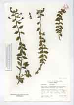
| Family | Campanulaceae |
| Identification | Burmeistera |
| Determined by | |
| Identification qualifier | |
| Field notes | Terrestrial herb with branches to 0.3 m long; branches, pedicels, corolla, calyx & lower surface of leaves green suffused with purple; filament tube pale green; anthers purplish gray. One plant seen |
| |
| This record has no coordinates. Display map with the 80 georeferenced records of Burmeistera in the AAU Herbarium Database. |
| New Search Modify Search |