| Collector | Clark, J.L. |
| Number | 1240 |
| Collected with | B.Greene, T.Harris, J.Smith, C.Watt. |
| Country | Ecuador |
| Subpart | Chimborazo |
| County | |
| Locality | Pallatanga. Comunidad Jesús del Gran Poder. From Panza Redonda (South Pan American Highway), 2 km S on cobble/dirt road, ca. 4 km NE of Pallatanga. Montane Wet Forest. |
| Coordinates | 1° 58' S 78° 56' W |
| Minimum elevation (m) | 2800 |
| Maximum elevation (m) | 3200 |
| Start date | 1995/07/10 |
| End date | 1995/07/14 |
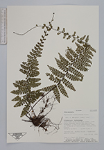
| Family | Aspleniaceae |
| Identification | Asplenium flabellulatum Kunze |
| Determined by | |
| Identification qualifier | |
| Field notes | Terrestrial. Rachis black. Fragmented mature forest. |
|
 Other records of Asplenium flabellulatum