AAU Herbarium Database |
| New Search Modify Search |
| Collector | Korning, J. |
| Number | 47769 |
| Collected with | Thomsen, K. |
| Country | Ecuador |
| Subpart | NAPO |
| County | |
| Locality | Añangu, NW corner of the "Parque Nacional Yasuní". Primary terra firme forest on permanent study plot S of SEF point 51, on the highest plateau in the area. KTH numbers refers to the tagging of all plot trees with DBH above 10 cm. |
| Coordinates | 0° 33' S 76° 22' W |
| Minimum elevation (m) | 355 |
| Maximum elevation (m) | 365 |
| Start date | 1986/02/01 |
| End date | 1986/02/15 |
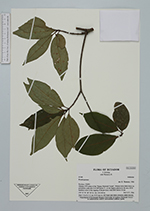
| Family | Araliaceae |
| Identification | Dendropanax Decne. & Planch. |
| Determined by | K. Thomsen, 1986 |
| Identification qualifier | |
| Field notes | Tree 7.5 m X 11.5 cm. KTH tree no. 609 Bark dark brick coloured, rather smooth. |
| |
| Display all 123 georeferenced records of Dendropanax Dendropanax |
| New Search Modify Search |