AAU Herbarium Database |
| New Search Modify Search |
| Collector | Knudsen, J. |
| Number | 135 |
| Collected with | L.Tollsten |
| Country | Ecuador |
| Subpart | Napo |
| County | |
| Locality | San Carlos INIAP station, 3 km after take off to the rigth at 30 km on the road Coca-Lago Agrio. |
| Coordinates | 0° 19' S 76° 55' W |
| Minimum elevation (m) | 300 |
| Maximum elevation (m) | 300 |
| Start date | 1991/05/23 |
| End date | 1991/05/23 |
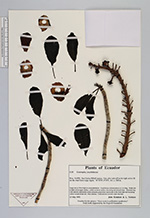
| Family | Lecythidaceae |
| Identification | Couroupita |
| Determined by | |
| Identification qualifier | |
| Field notes | Large tree to 30 m. high in cacao plantation. Cauliflorous inflorescences to 2 m. long. Petals red to dark red on upper surface, yellow on lower surface, becoming red towards base. Staminal ring with stamens-staminodes in the hood dark red becoming yellow toward distal end. Fruit globose. collected tree recently came into leaf. |
| |
 Other records of Couroupita Other records of CouroupitaThe map displays only records from the Aarhus Herbarium Database. The records may not represent the full distribution of Couroupita |
| New Search Modify Search |