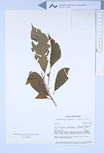
| Collector | Jaramillo, J. |
| Number | 31537 |
| Collected with | Coello, F. & Freire, A. |
| Country | Ecuador |
| Subpart | PASTAZA |
| County | |
| Locality | Lorocachi. En margen derecha del Río Curaray, aguas abajo, a unos 3 km del campamento militar. Bosque primario. |
| Coordinates | 1° 38' S 75° 58' W |
| Minimum elevation (m) | 200 |
| Maximum elevation (m) | 200 |
| Start date | 1980/05/30 |
| End date | 1980/05/30 |
| Family | Dilleniaceae |
| Identification | Doliocarpus dentatus (Aubl.)Standl. |
| Determined by | Aymard, G. (MO), 1997. |
| Identification qualifier | |
| Field notes | Shrub 0.8 m. Primary forest. Flowers white. Anthers yellow. Numerous stamens. |
|
 Other records of Doliocarpus dentatus