AAU Herbarium Database |
| New Search Modify Search |
| Collector | Jaramillo, J. |
| Number | 31374 |
| Collected with | Coello, F. & Freire, A. |
| Country | Ecuador |
| Subpart | PASTAZA |
| County | |
| Locality | Lorocachi. A 2 km, margens izquierda del Río Curaray, aquas abajo, al este del campamento militar. Bosque primario y secundario. |
| Coordinates | 1° 38' S 75° 58' W |
| Minimum elevation (m) | 200 |
| Maximum elevation (m) | 200 |
| Start date | 1980/05/29 |
| End date | 1980/05/29 |
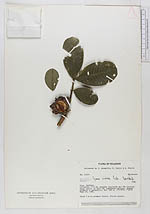
| Family | Meliaceae |
| Identification | Guarea cristata Pennington |
| Determined by | T. D. Pennington |
| Identification qualifier | |
| Field notes | Shrub 4 m in primary forest. Fruits purple. |
| |
 Other records of Guarea cristata Other records of Guarea cristataThe map displays only records from the Aarhus Herbarium Database. The records may not represent the full distribution of Guarea cristata |
| New Search Modify Search |