AAU Herbarium Database |
| New Search Modify Search |
| Collector | Wessels Boer, J.G. |
| Number | 1874 |
| Collected with | |
| Country | Venezuela |
| Subpart | Amazonas |
| County | |
| Locality | Near Puerto Ayacucho, between airport and Rio Cataniapo; slightly disturbed mesophytic forest and open savanna |
| Coordinates | 5° 40' N 67° 38' W |
| Minimum elevation (m) | 0 |
| Maximum elevation (m) | 0 |
| Start date | 1967/07/25 |
| End date | 1967/07/25 |
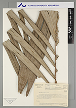
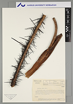
| Family | Arecaceae |
| Identification | Astrocaryum munbaca Mart. |
| Determined by | |
| Identification qualifier | |
| Field notes | Clustered palm, an about 2 m tall stem with small basal shoots; 13 contemporaneous leaves, sheath 8 dm long, petiole 2 dm long, rachis 19 dm long; 21 pairs of pinnae all in the same plane, 7,5 dm long with an about 3 dm long fusiform part; peduncle 8 dm long, rachis 2 dm long. Fruit slightly immature. Frequent in mesophytic forest. |
| |
 Other records of Astrocaryum munbaca Other records of Astrocaryum munbacaThe map displays only records from the Aarhus Herbarium Database. The records may not represent the full distribution of Astrocaryum munbaca |
| New Search Modify Search |