| Collector | Smith, J.F. |
| Number | 6494 |
| Collected with | B.Ertter |
| Country | USA |
| Subpart | Oregon |
| County | |
| Locality | T10S R34E s1/12. John day Wilderness area, north slope down from Vinegar Hill, ca 40 airmiles W Baker city, rocky NE-facing slope of cirque at head of East Fork Clear Creek |
| Coordinates | 44° 43' 8'' N 118° 33' 49'' W |
| Minimum elevation (m) | 7177 |
| Maximum elevation (m) | 7177 |
| Start date | 2006/07/25 |
| End date | 2006/07/25 |
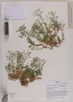
| Family | Caryophyllaceae |
| Identification | Minuartia nuttallii (Pax) Briq. |
| Determined by | |
| Identification qualifier | |
| Field notes | Ultramafic outcrops and boulder field above meadow and subalpine fir, corolla white, stems in clumps |
|