AAU Herbarium Database |
| New Search Modify Search |
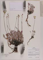
| Collector | Smith, J.F. |
| Number | 5677 |
| Collected with | |
| Country | USA |
| Subpart | Idaho |
| County | |
| Locality | T10S R2W s. 6ne. Along Mud Flat Road, near Bennet Reservoir, disturbed rocky soil with spots of sand |
| Coordinates | 42° 35' 17'' N 116° 36' 56'' W |
| Minimum elevation (m) | 5495 |
| Maximum elevation (m) | 5495 |
| Start date | 2005/06/25 |
| End date | 2005/06/25 |
| Family | Polygonaceae |
| Identification | Eriogonum ochrocephalum S.Watson |
| Determined by | |
| Identification qualifier | |
| Field notes | Leaves gray-green, inflorescence white |
| |
 Other records of Eriogonum ochrocephalum Other records of Eriogonum ochrocephalumThe map displays only records from the Aarhus Herbarium Database. The records may not represent the full distribution of Eriogonum ochrocephalum |
| New Search Modify Search |