AAU Herbarium Database |
| New Search Modify Search |
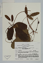
| Collector | Maxwell, J.F. |
| Number | 91-798 |
| Collected with | |
| Country | Thailand |
| Subpart | Chiang Mai |
| County | |
| Locality | Mae Soi Valley, Mae Soi Subdistrict, rugged limestone cliffs/ridges above Mae Soi Stream |
| Coordinates | |
| Minimum elevation (m) | 700 |
| Maximum elevation (m) | 0 |
| Start date | 1991/09/30 |
| End date | 0/00/00 |
| Family | Fabaceae |
| Identification | Dunbaria bella Prain |
| Determined by | |
| Identification qualifier | |
| Field notes | Open places on rigged limestone terrain, deciduous forest; fire-prone area vine, often twining, stems green; inflorescence axes, lower 1/2 calyx tube green, calyx tube otherwise & lobes dull reddish; standard dark maroon on both sides; wings & keel ligth green; leaflets dark green above, light green underneath |
| |
| This record has no coordinates. Display map with the 7 georeferenced records of Dunbaria bella in the AAU Herbarium Database. |
| New Search Modify Search |