AAU Herbarium Database |
| New Search Modify Search |
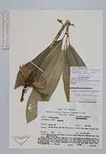
| Collector | Maxwell, J.F. |
| Number | 91-686 |
| Collected with | |
| Country | Thailand |
| Subpart | Chiang Mai |
| County | |
| Locality | Mae Soi Ridge, Mae Soi subdistrict, Ban Bah Gluay (Mao village) area. Poen, grassy, disturbed mixed evergreen hardwood pine forest. Granite bedrock. |
| Coordinates | |
| Minimum elevation (m) | 1475 |
| Maximum elevation (m) | 1475 |
| Start date | 1991/07/20 |
| End date | 1991/07/20 |
| Family | Zingiberaceae |
| Identification | Zingiber densissimum S.Q.Tong & Y.M.Xia |
| Determined by | P.Triboun |
| Identification qualifier | |
| Field notes | Stems light green, lowest part dull light reddish; peduncles whitish; bracts whitish to pale light yellowish, tips often with pinkish hue; filled with a clea?jelly-like fluid; calyx translucent white, tips pink; entire corolla, lip white; anther crest yellow, locules cream, connective whitish; blades dark green above, light green underneath. |
| |
| This record has no coordinates. Display map with the 1 georeferenced records of Zingiber densissimum in the AAU Herbarium Database. |
| New Search Modify Search |