AAU Herbarium Database |
| New Search Modify Search |
| Collector | Maxwell, J.F. |
| Number | 91-1055 |
| Collected with | |
| Country | Thailand |
| Subpart | Prae |
| County | |
| Locality | District Song. Mae Yom National Park, north part, west side of the Yom River in the Mae Den Region; Sahiab Subdistrict. Open, often rocky, fire-prone disturbed deciduous dipterocarp forest; shale granite bedrock. |
| Coordinates | |
| Minimum elevation (m) | 225 |
| Maximum elevation (m) | 225 |
| Start date | 1991/11/14 |
| End date | 1991/11/14 |
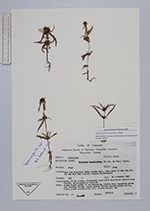
| Family | Rubiaceae |
| Identification | Spermacoce pusilla Wall. |
| Determined by | R.Salas |
| Identification qualifier | |
| Field notes | Stems light green to stramineous, nearly dry; capsules green aand turning brown; seeds glossy brown; blades green above, light green underneath; most plant nearly dry. |
| |
| This record has no coordinates. Display map with the 1 georeferenced records of Spermacoce pusilla in the AAU Herbarium Database. |
| New Search Modify Search |