AAU Herbarium Database |
| New Search Modify Search |
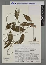
| Collector | Maxwell, J.F. |
| Number | 90-986 |
| Collected with | |
| Country | Thailand |
| Subpart | Chiang Mai |
| County | |
| Locality | Muang District. Doi Sutep-Pui National Park, east side, near the Park Headquarters along the dirt road to Chang Kian Village, Chang Kian Valley. |
| Coordinates | |
| Minimum elevation (m) | 1050 |
| Maximum elevation (m) | 1050 |
| Start date | 1990/09/11 |
| End date | 1990/09/11 |
| Family | Acanthaceae |
| Identification | Thunbergia laevis var. vestita (Nees) L.H.Cramer |
| Determined by | H. Balslev |
| Identification qualifier | |
| Field notes | Open to partly shaded, mostly disturbed places along the dirt road in the primary evergreen forest; granit bedrock. Vine; stems, petioles, pedicels, bracts, calyx light green; corolla, stigma, style white; corolla throat with a pale light yellowish blot below one of the lobes; immature capsules dark green; blades dark green above, light green below. In liquid collection. Topotype. |
| |
| This record has no coordinates. Display map with the 1 georeferenced records of Thunbergia laevis var. vestita in the AAU Herbarium Database. |
| New Search Modify Search |