AAU Herbarium Database |
| New Search Modify Search |
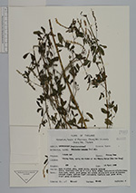
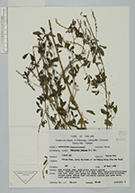
| Collector | Maxwell, J.F. |
| Number | 89-461 |
| Collected with | |
| Country | Thailand |
| Subpart | Chiang Mai |
| County | |
| Locality | Chiang Saen, along the danks of the Mekong River (Mae Nam Kong) |
| Coordinates | |
| Minimum elevation (m) | 450 |
| Maximum elevation (m) | 0 |
| Start date | 1989/04/16 |
| End date | 0/00/00 |
| Family | Fabaceae |
| Identification | Melilotus indicus (L.)All. |
| Determined by | |
| Identification qualifier | |
| Field notes | Open alluvial area , woody place, granite bedrock erect, branching herb up to 1.5 m tallæ stem, inflorescence/ infructescen axes , calyx, pods green; ll petals yellow with paler yellowish-whitish claws; anthers light yellowish; leafltes dark green above, light green underneath. |
| |
| This record has no coordinates. Display map with the 9 georeferenced records of Melilotus indicus in the AAU Herbarium Database. |
| New Search Modify Search |