AAU Herbarium Database |
| New Search Modify Search |
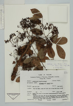
| Collector | Maxwell, J.F. |
| Number | 89-286 |
| Collected with | |
| Country | Thailand |
| Subpart | Maehongson |
| County | |
| Locality | Huay Mae Maht, along the dirt road to Mae Sahm Lahp village, Mae Sariang |
| Coordinates | |
| Minimum elevation (m) | 350 |
| Maximum elevation (m) | 0 |
| Start date | 1989/03/01 |
| End date | 0/00/00 |
| Family | Fabaceae |
| Identification | Dalbergia cana Kurz |
| Determined by | C. Niyomdham |
| Identification qualifier | |
| Field notes | Partly open place in the mixed evergreen/ deciduous forest; granite bedrock deciduous tree 18 m, dbh 54 cm; bark slightly thickened, flaking, brown; inflorescences mostly on leafless branches, axes dull reddish; calyx maroon; standard, wings white, keel pinkish; leaflets falling off now, green above, light green underneath |
| |
| This record has no coordinates. Display map with the 3 georeferenced records of Dalbergia cana in the AAU Herbarium Database. |
| New Search Modify Search |