AAU Herbarium Database |
| New Search Modify Search |
| Collector | Maxwell, J.F. |
| Number | 87-683 |
| Collected with | |
| Country | Thailand |
| Subpart | Peninsular |
| County | |
| Locality | Phattalung. Tamota. Tamota falls forest park. Mostly shaded area along the river, primary evergreen forest; granitic bedrock |
| Coordinates | |
| Minimum elevation (m) | 150 |
| Maximum elevation (m) | 150 |
| Start date | 1987/05/23 |
| End date | 1987/05/23 |
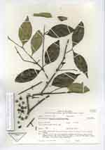
| Family | Melastomataceae |
| Identification | Memecylon minutiflorum Miq. |
| Determined by | Lahiru Wijedasa |
| Identification qualifier | |
| Field notes | Tree 7 m, dbh 15 cm; bark vertically cracked and flaking, light brown; fruits greenish and turning black and juicy, 8 x 10 mm when fresh; blades dark green above, light green underneath |
| |
| This record has no coordinates. Display map with the 3 georeferenced records of Memecylon minutiflorum in the AAU Herbarium Database. |
| New Search Modify Search |