AAU Herbarium Database |
| New Search Modify Search |
| Collector | Maxwell, J.F. |
| Number | 87-580 |
| Collected with | |
| Country | Thailand |
| Subpart | Trang |
| County | |
| Locality | Muang District. Kao Chong Forest, entrance to the White Trail. Partly open margins of the primary evergreen forest; granitic bedrock. |
| Coordinates | |
| Minimum elevation (m) | 250 |
| Maximum elevation (m) | 250 |
| Start date | 1987/06/18 |
| End date | 1987/06/18 |
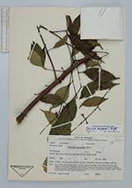
| Family | Clusiaceae |
| Identification | Garcinia merguensis Wright |
| Determined by | C. Ngernsaengsaruay |
| Identification qualifier | |
| Field notes | Tree 5 m; dbh 8 cm; bark smooth, grey; sap from cut branchlets cream-light yellowish; pedicels and sepals dark green; petal buds light green; mature petals 4, yellow, stamens also yellow; pistillods bright red; blades dark green above, green underneath. ♂. |
| |
| This record has no coordinates. Display map with the 16 georeferenced records of Garcinia merguensis in the AAU Herbarium Database. |
| New Search Modify Search |